Vermeer’s Maps
Look past the figure in a Vermeer interior and the wall behind her is often a map. They were real, printed maps you could have bought in Amsterdam, and he copied them with a cartographer’s care. Here is what the maps meant, and a guide to every painting that holds one.
A map on the wall
Johannes Vermeer, the Dutch painter who worked in the small city of Delft in the 1660s, is famous for quiet rooms. A woman reads a letter by a window, a maid pours milk, the light is soft and very little seems to be happening. Look past the figure, though, and you keep meeting the same thing on the back wall: a map. A large printed map of Holland, or of Europe, or of the whole Low Countries, hanging just over her shoulder.
These maps were not invented to fill the space. They were real, identifiable objects, printed in Amsterdam, the mapmaking capital of Europe at the time, and Vermeer copied them so faithfully that more than three centuries later an art historian could match each painted map to its printed source, sometimes down to the creases. One map he liked enough to hang on his wall three separate times.
Why hang a map?
To understand the maps, it helps to know the moment. Vermeer was painting in a young country. The Dutch Republic had only recently won its independence from Spain, and it was growing rich on sea trade, its ships reaching the Mediterranean, the Baltic, and as far as Asia. Maps and globes were both the tools of that expansion and a source of national pride, and the Republic produced the finest of them, by famous houses like Blaeu, Hondius, and Visscher.
A printed map was also an expensive thing to own, and people hung them on the wall the way they hung pictures, as decoration and as a quiet sign of standing and worldliness. A map in a painted room is therefore a true-to-life detail of a comfortable Dutch home, and a soft boast about the reach of the country beyond the window.
There is a gentler reading too. In the letter-reading scenes, where a woman pores over a note from someone who is not there, a map of the wider world can stand for distance itself, for the space between two people and the travelling that keeps them apart. It is worth saying that maps were also simply fashionable, so not every one has to carry a hidden message, but Vermeer chose his with unusual care.
The map he painted three times
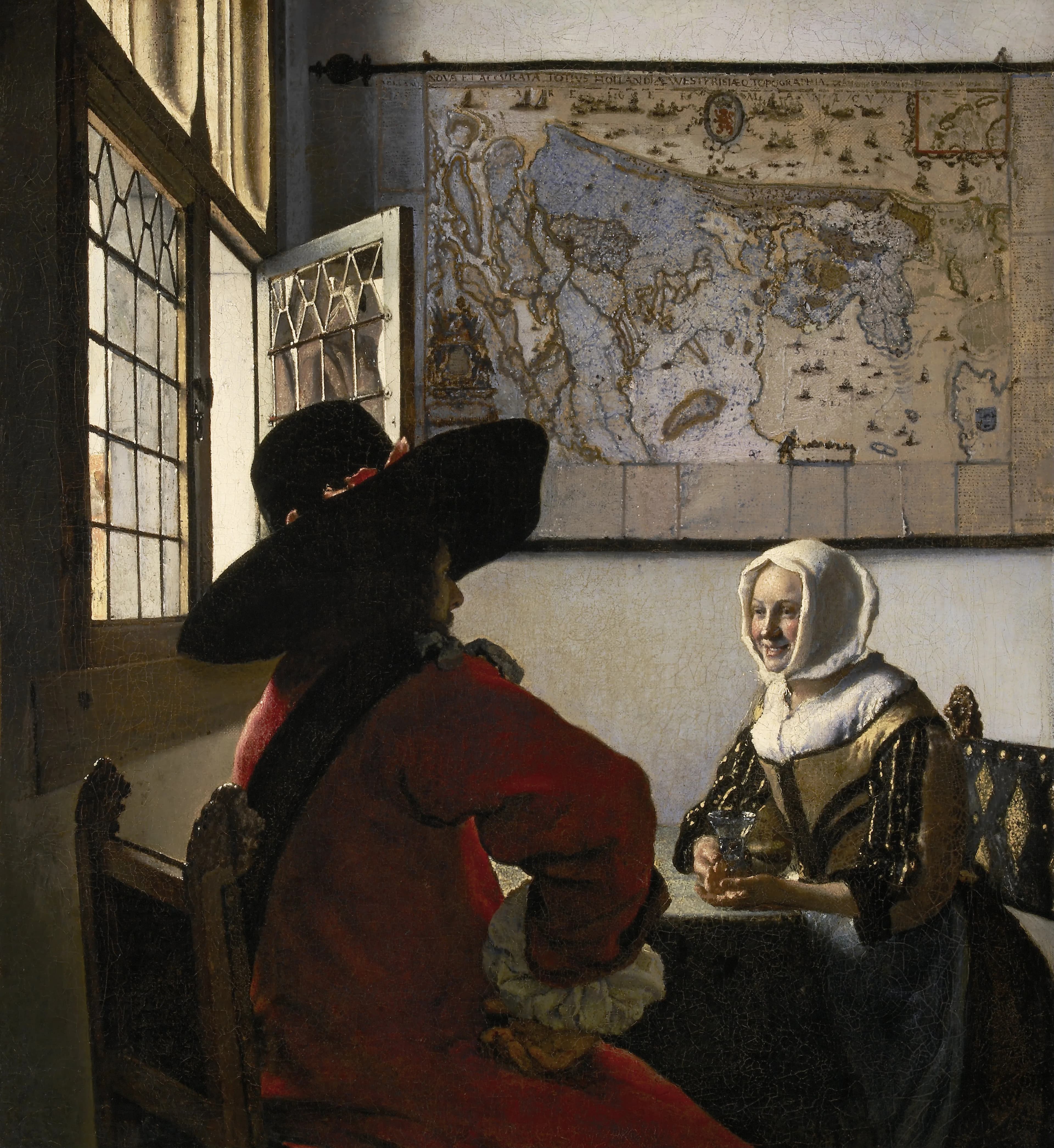
The map that turns up most often is a big wall map of Holland and West Friesland, the watery province around Amsterdam. It was drawn by Balthasar Florisz. van Berckenrode and published by Willem Jansz. Blaeu around 1620, printed from seventeen copperplates into a sheet almost a metre and a half wide. Oddly to a modern eye, it is turned on its side, with west at the top rather than north. Only one original example is known to survive anywhere, kept at a museum in the town of Hoorn.
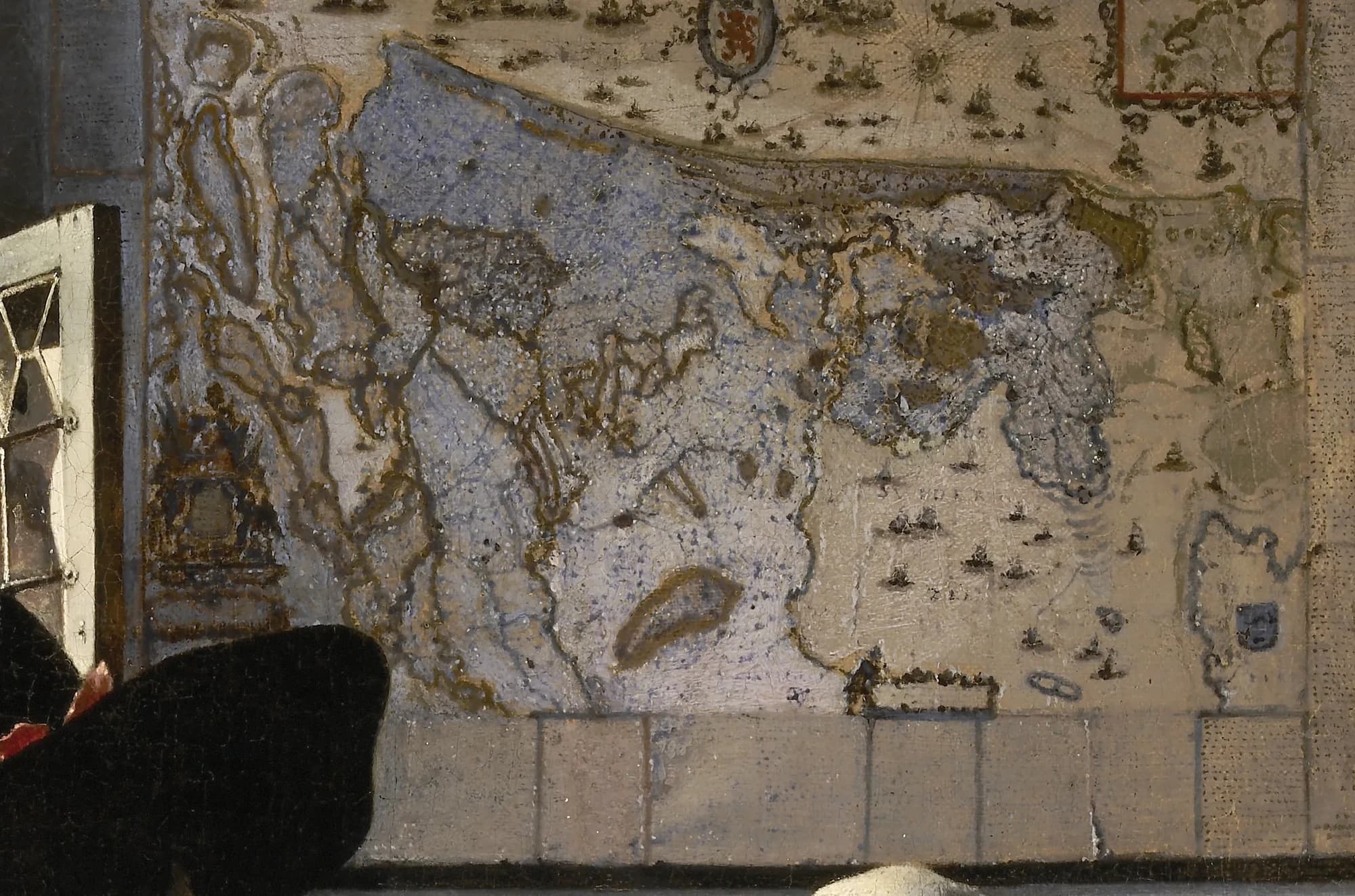
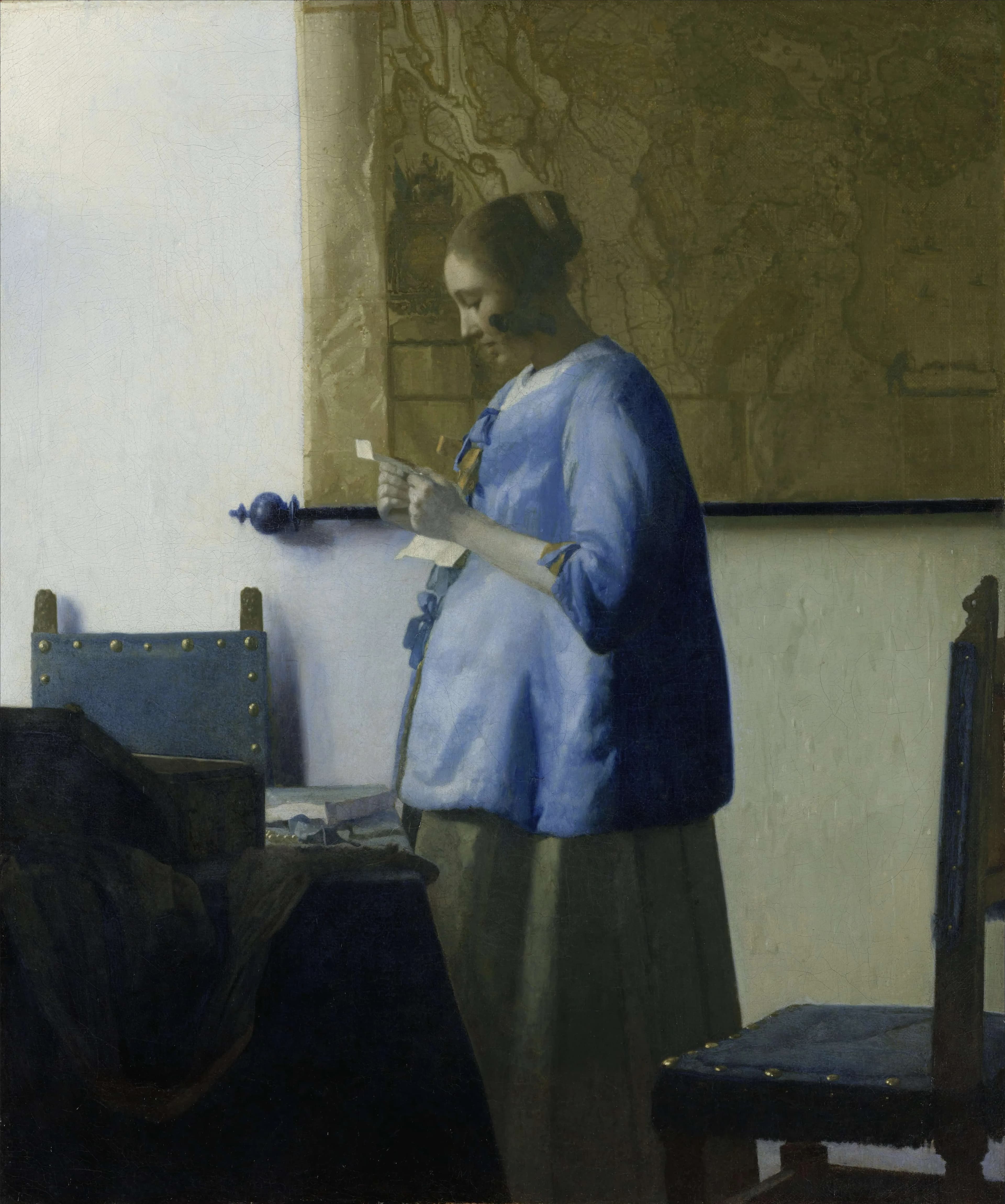
Vermeer hung this one map in three different paintings. It is bright and golden behind the soldier in Officer and Laughing Girl, dim and bluish behind the pregnant reader in Woman in Blue Reading a Letter, and pushed to the shadowy edge of The Love Letter.
The same object, painted from the same source, becomes a different thing in each room depending on how the light falls. In two of the three a woman is reading a letter beneath it, and the map of her own small, sea-bound country quietly widens the scene to the world the letter might have crossed.
More maps, more provinces
Holland was not the only place on Vermeer’s walls. In Woman with a Lute, a young woman tunes her instrument by a window, and the map behind her is a map of all of Europe, first printed by Jodocus Hondius. Curiously, scans beneath the paint show that Vermeer began with a map of the Netherlands there and changed his mind, painting Europe over it instead.
In Young Woman with a Water Pitcher, a map of the Seventeen Provinces of the Netherlands hangs at the right, half lost in shadow and partly hidden behind the woman and the window frame. He was not above removing a map entirely, either. In Woman with a Pearl Necklace, infrared imaging reveals a large map that he sketched onto the back wall and then painted out, leaving the bare, light-filled plaster we see today.
The grandest map of all
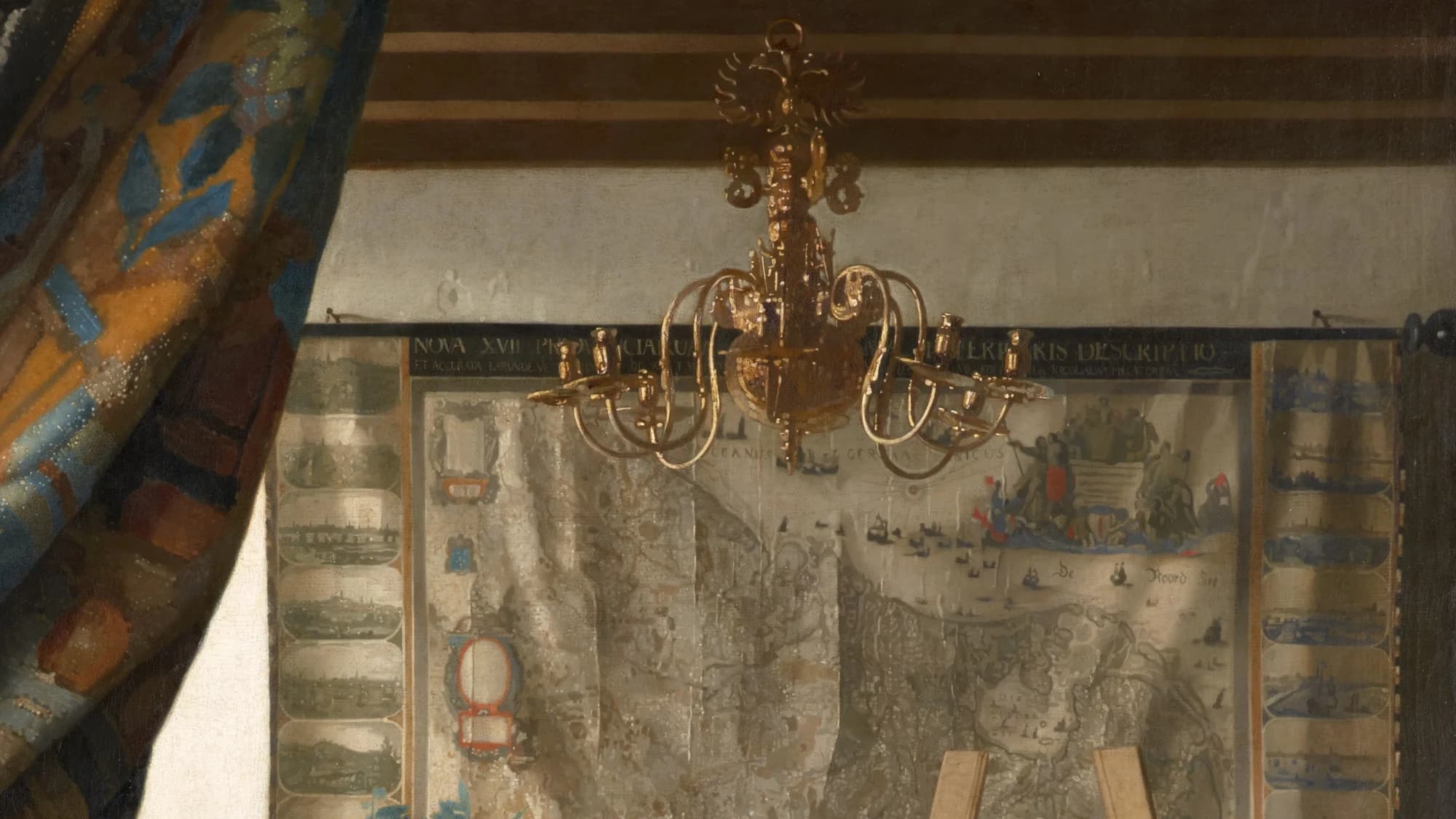
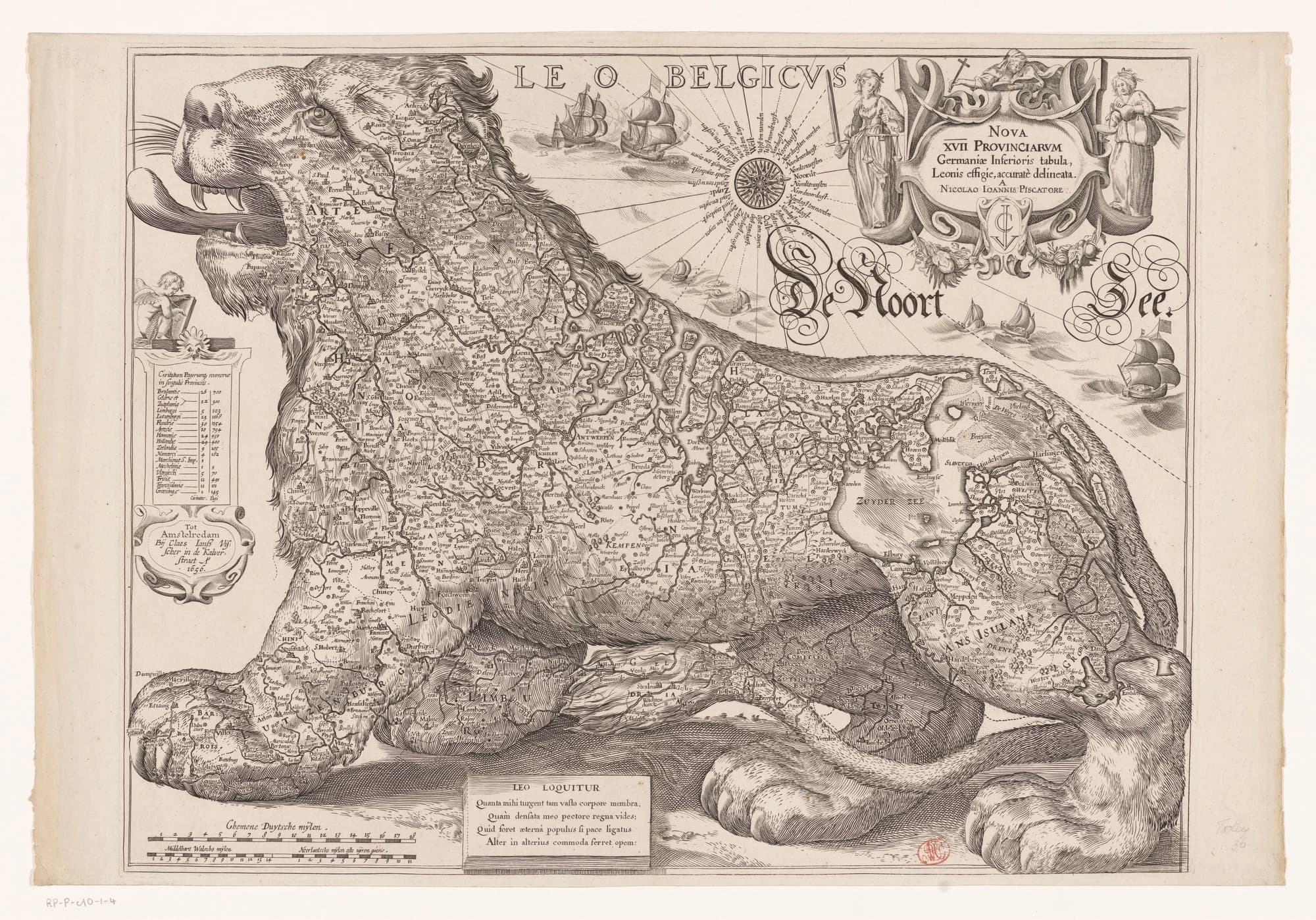
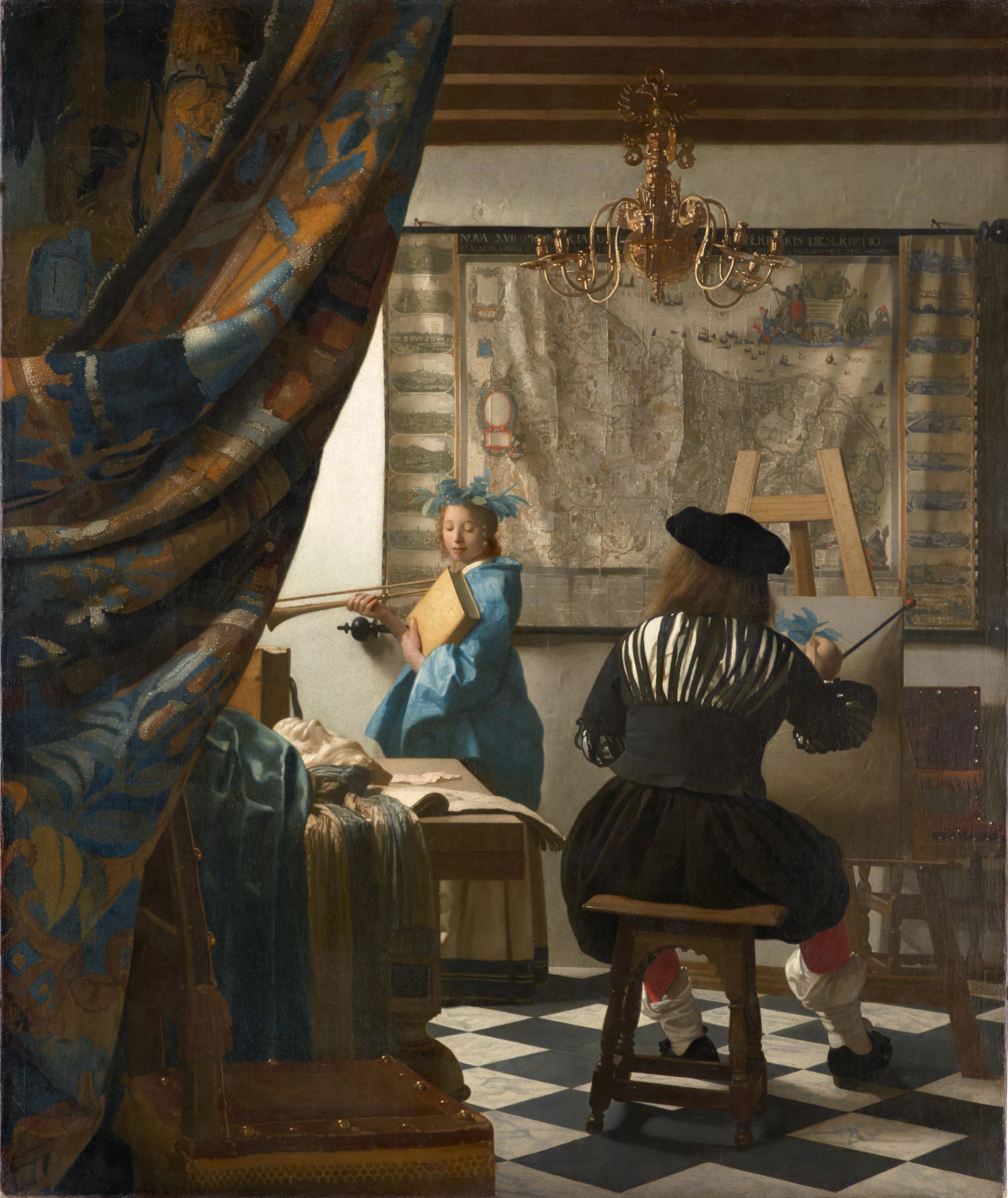
The most spectacular map Vermeer ever painted spreads across the back wall of The Art of Painting, the large and elaborate picture he seems to have kept for himself. It is a map of the Seventeen Provinces, the whole of the Low Countries, published by the Amsterdam house of Claes Jansz. Visscher, with a row of little views of Netherlandish towns running down each side like a decorated border.
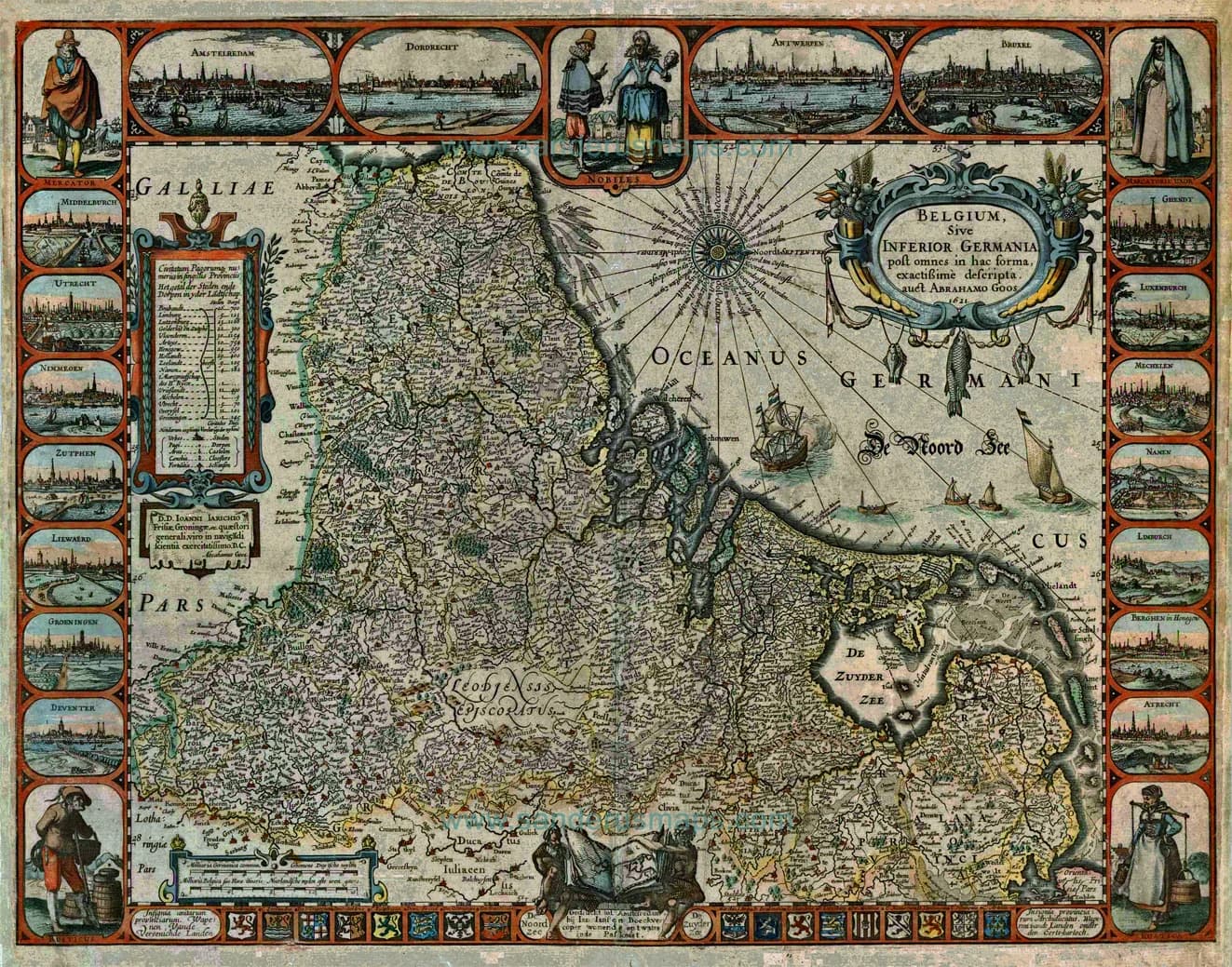
The map shows the country as a single whole, the way it had been before the northern provinces broke away from Spain. A pronounced vertical fold runs down it, close to the line that came to separate the Dutch north from the Spanish south. Some read that crease as a quiet comment on a divided land, others as nothing more than the sag of an old map that has hung too long.
Whatever it means, it is a tour de force of painting. Vermeer catches the sheen of the varnished surface, the brittle cracks, and the soft ripples of paper, so that a flat printed sheet seems to breathe on the wall.
From maps to globes
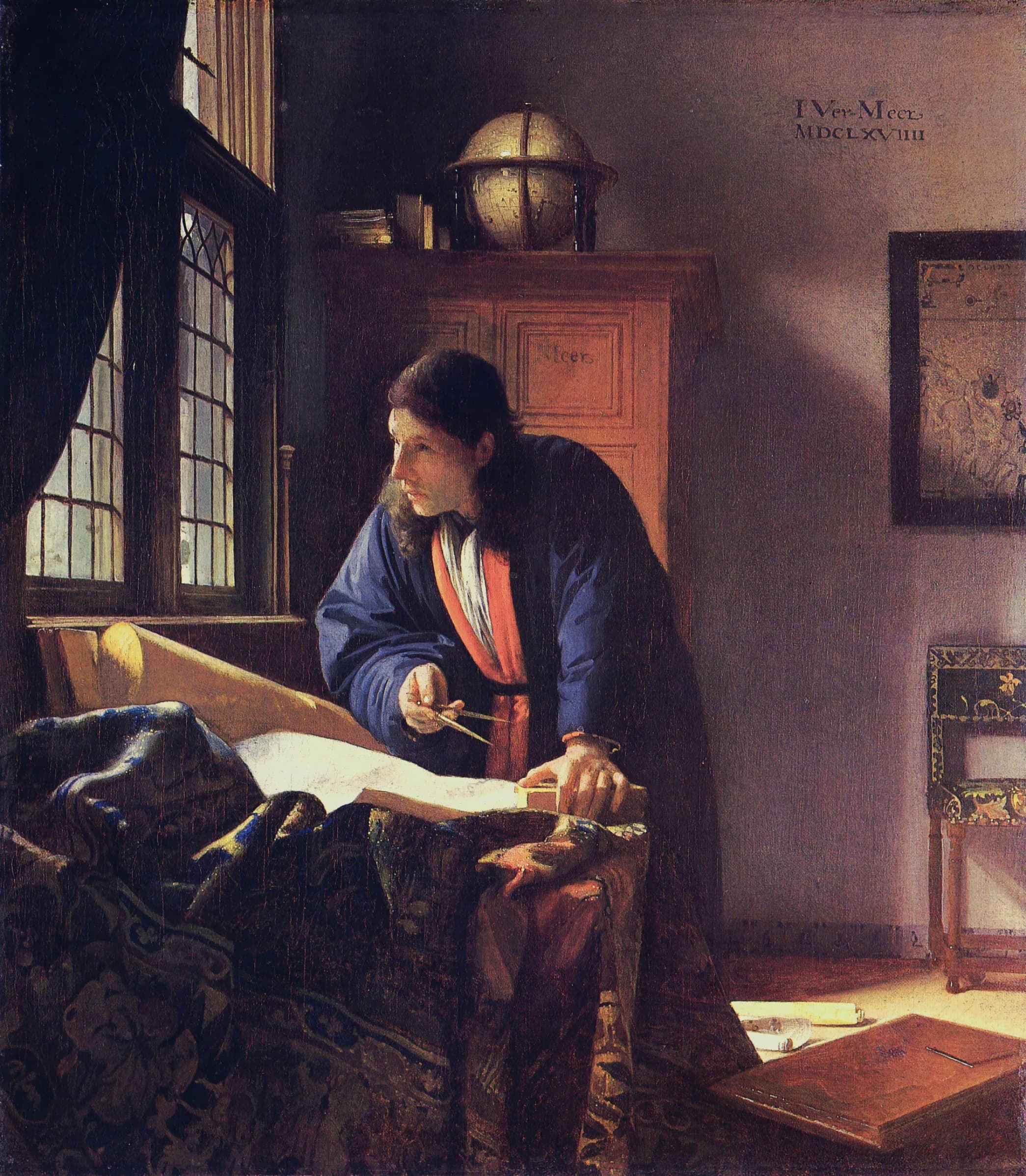
Twice Vermeer swapped the flat map for a round one. In The Geographer, a man looks up from his charts with a pair of dividers in his hand. A sea chart of the coasts of Europe by Willem Jansz. Blaeu hangs on the wall, and a terrestrial globe by Jodocus Hondius stands on the cupboard, turned to show the Indian Ocean, the very route Dutch ships sailed to reach Asia.
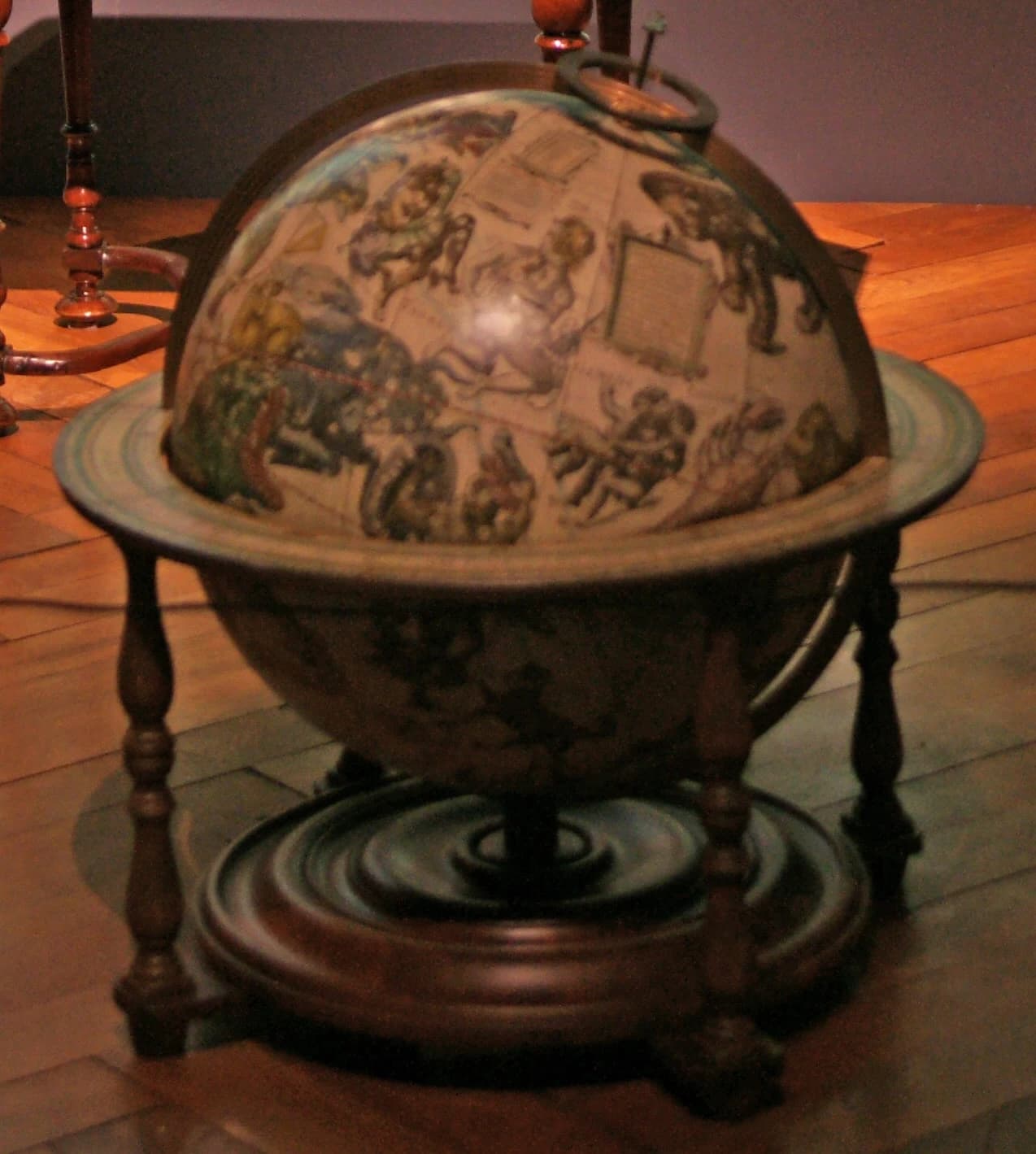
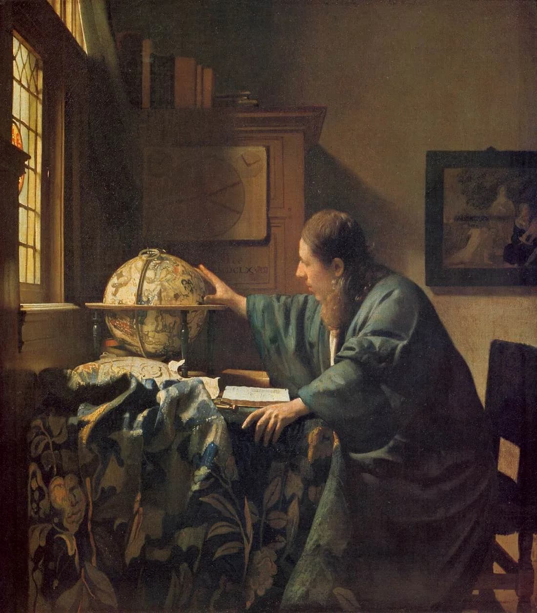
Its companion piece, The Astronomer, does the same trick with the sky. Here the scholar reaches toward a celestial globe, a sphere printed not with coastlines but with the figures of the constellations, the heavens charted as carefully as any ocean.
Globes carried a second meaning as well. In the art of the time a globe could be a reminder of how small and brief a human life is against the size of the world, so a man bent studiously over one is also, gently, a man measuring his own place in it.
Reading the walls
None of this was unique to Vermeer. Plenty of Dutch painters put a map on a wall. What sets him apart is the care, the way he tracked down real printed maps and reproduced them so exactly that we can still name the publisher, and the patience with which he matched each one to the person beneath it. The map is never just a backdrop. It is a second, quieter subject, opening the small hushed room onto a whole mapped world.
The walls of Vermeer’s rooms reward a slow look in other ways too. As often as he hung a map there, he hung a painting, chosen just as deliberately to comment on the scene below it. That is a story of its own, told in Paintings Within Paintings.
Notes
- 1.The maps were matched to their printed sources by the art historian James A. Welu in “Vermeer: His Cartographic Sources,” The Art Bulletin 57, no. 4 (1975), 529–547. A summary of his identifications is kept at Essential Vermeer, “Vermeer’s Maps”.
- 2.On printed maps as luxury wall decoration and a mark of standing in seventeenth-century Dutch homes, see Essential Vermeer, “Vermeer’s Maps”, and Wikipedia, “Dutch Golden Age”.
- 3.The wall map of Holland and West Friesland was drawn by Balthasar Florisz. van Berckenrode and published by Willem Jansz. Blaeu around 1620. It was printed from seventeen copperplates, measured about 93 by 143 cm, and is oriented with west at the top. A single original example survives, at the Westfries Museum in Hoorn. See Essential Vermeer, “Vermeer’s Maps” and Wikipedia, “Officer and Laughing Girl”.
- 4.The same Berckenrode and Blaeu map appears in Officer and Laughing Girl (The Frick Collection, New York), Woman in Blue Reading a Letter (Rijksmuseum, Amsterdam), and The Love Letter (Rijksmuseum), each time lit and shadowed differently. See Essential Vermeer, “Vermeer’s Maps”.
- 5.The map behind the player in Woman with a Lute (Metropolitan Museum of Art) is a map of Europe first issued by Jodocus Hondius around 1613 and reprinted by Joan Blaeu in 1659; infrared imaging shows Vermeer first painted a map of the Netherlands there and then replaced it. See Essential Vermeer, “Woman with a Lute”.
- 6.The partly hidden map in Young Woman with a Water Pitcher (Metropolitan Museum of Art) is a map of the Seventeen Provinces of the Netherlands printed from copperplates associated with Huyck Allart. See Essential Vermeer, “Vermeer’s Maps”.
- 7.Infrared reflectography of Woman with a Pearl Necklace (Gemäldegalerie, Berlin) shows a large wall map sketched in and then painted out before the picture was finished. See Essential Vermeer, “Vermeer’s Maps”.
- 8.The map in The Art of Painting (Kunsthistorisches Museum, Vienna) is a map of the Seventeen Provinces, or Germania Inferior, associated with the Amsterdam publisher Claes Jansz. Visscher, flanked by views of twenty Netherlandish towns. See Essential Vermeer, “The Art of Painting” and Wikipedia, “The Art of Painting”.
- 9.The map shows the Low Countries as a single whole, as they had been before the northern provinces broke from Spanish rule. A prominent vertical fold runs down it close to the line that came to divide the Dutch north from the Spanish south, and some scholars read it as a quiet nod to that division, while others take it simply as the natural creasing of an old hanging map. See Wikipedia, “The Art of Painting”.
- 10.On the wall of The Geographer (Städel Museum, Frankfurt) hangs a sea chart of the coasts of Europe by Willem Jansz. Blaeu, and on the cupboard stands a terrestrial globe made by Jodocus Hondius around 1600, turned to show the Indian Ocean. See Essential Vermeer, “The Geographer”.
- 11.Its companion, The Astronomer (Louvre, Paris), sets a celestial globe by Jodocus Hondius in the same role, the heavens mapped in place of the seas. See Wikipedia, “The Astronomer”.